-
19
Mar
Tips for Driving in Severe Spring Weather
 After a very long and snowy winter, spring is finally just around the corner. But even though the threat of snow and ice is mostly gone, spring still brings its own weather-related messes, especially in the Midwest. No one wants to get caught driving in conditions where they do not know how to proceed, and while some decisions will depend on the situation, here are some go-to tips for driving in severe spring weather:
 -
- Wind speeds can be underestimated, but if you are hauling an empty trailer, it can be an issue for big trucks. So make sure to reduce your speed or pull over to wait out the wind if it is above 60 mph. If you do pull over, either park next to a building to cut down on the wind or park with your trailer facing the direction of the wind.
- Heavy rain makes for slippery roads. Be sure to reduce your speed and know that it will take longer to stop than usual. Be even more cautious about keeping a safe amount of distance between you and other vehicles on the road. Heavy rain can also make visibility drop so be sure to have your wipers on. And if you have your wipers on, most states require your lights to be on as well to brighten your path. Be sure your windshield wiper fluid levels are always at an appropriate level.
- Flooding is caused by the heavy downpour of rain over a short period of time. Driving in high waters can create water log and damage your truck. Flooding also stops you from being able to see the road, meaning all those potholes from winter weather will be a hidden danger. Flooding can also get worse very quickly, so it is important to keep an eye on the rising water levels and get to higher roads that are less likely to flood.
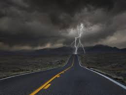
- Lightning is always an issue while driving in a storm, but if you are the biggest vehicle on the road, you are basically a lightning rod. If there is a lot of close lightning be sure to pull into the closest truck stop away from the gas pumps and wait until the lightning has moved away from your route.
- Hail can cause a lot of damage to trucks and make roads hard to drive on. If it starts to hail, it is best to get under a covered area or away from the direction the hail is falling.
- Tornadoes are a Midwest given this time of year, but most of the time, there are enough advance warnings to prepare yourself. The safest thing you can do in the event of a tornado is to get to the nearest truck or rest stop and take cover. But if you are on the road and can’t get to a stop, DO NOT pull under an overpass. This is a complete myth and can actually be more dangerous as overpasses can become wind tunnels and pull your truck. Instead, you should pull over in a less populated area that is out of the tornado’s path. According to Roger Edwards with the Storm Prediction Center, you should only leave your truck if you can safely get to an area below the roads (i.e. a ditch) and away from any vehicles. Lower yourself to the ground and cover your head with your hands and a cushion-like item. If there are no lower areas, stay in your truck with your head covered and below windows. After the immediate threat is over, get back in your truck careful to watch for debris and down power lines.
It is your responsibility to keep an eye on the radar and track weather to see if and when it is safe to continue your route. It is important to know the terms meteorologists use to stay further in the know, so here are some commonly used weather terms from weather.gov:
- Severe thunderstorm watch/warning is a thunderstorm producing damaging winds (trees down, etc.) or winds 58 mph or more and/or hail three-quarter of an inch or greater in diameter.
- Flash flood is a flood that occurs suddenly during or shortly following heavy rains or from a sudden release of water (as in a dam break). Small streams and creeks usually react the fastest to heavy rains and rise several feet in hours or even minutes. Flash floods can also be caused by ice jams. Be sure to keep an eye on what areas are encompassed in the warning and plan your route accordingly.
- Tornado watches are issued by the Storm Prediction Center for counties where tornadoes may occur. The watch area is typically large, covering numerous counties or even states. Weather conditions favor thunderstorms that are capable of producing tornadoes. This is a good time to make sure you have an emergency plan and supplies ready in case the watch turns into a warning. If you are on the road, make note of the nearest rest stops.
- Tornado warnings are when a tornado has been sighted or indicated by weather radar. There is an imminent danger to life and property. Warnings are issued by your local forecast office. Warnings typically encompass a much smaller area (around the size of a city or small county) that may be impacted by a tornado identified by a forecaster on radar or by a trained spotter/law enforcement who is watching the storm.
Avoid stopping on the road shoulders, if at all possible, as to avoid confusing other drivers. Turn on your flashers and get off the road as safely and quickly as possible. Always have a weather-preparedness bag with you. Some of the items change with the change in the type of weather, but always have a flashlight, non-perishable food items, water, and an emergency aid kit on hand. Be even more aware at night as you cannot always gage the cloud coverage in the dark. While pulling over and losing time is never ideal, your safety should be your number one priority, just make sure to notify dispatch. Be sure to pay attention to your radios if there looks to be a threat for severe weather and stay aware of your surroundings.
For more information:
https://www.spc.noaa.gov/faq/tornado/safety.html
https://www.weather.gov/safety/tornado-ww
https://cdllife.com/2012/tips-for-spring-driving/
http://cdltrainingspot.com/12-tips-for-driving-a-truck-in-windy-conditions/
-